Green Bay & Northeast Wisconsin

Show buyers your property.
Bring customers inside.

Professional drone photos and videos for real estate, businesses, aerial inspections, and custom projects across Northeast Wisconsin.

  • FAA Part 107 certified
  • Locally owned. Personally flown.
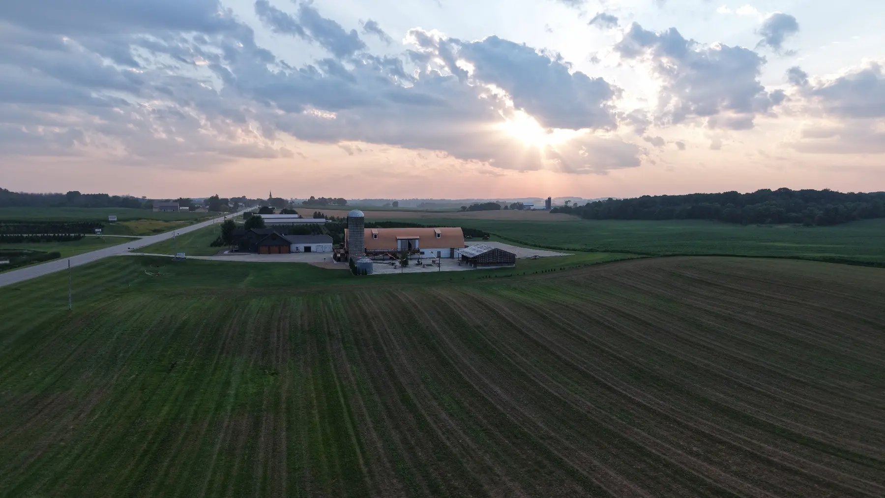
Wisconsin farmland and a barn beneath a broad, colorful sunset, photographed from the air
Wisconsin, from a new perspective.View the portfolio ↗
Simple from start to finish

From your first idea to the final view.

You do not need to know drone terminology or choose every shot yourself. A few project details are enough to get started.

  1. Share your project

    Tell me what needs to be captured, the location, your preferred date, and how you plan to use the finished media.

  2. Confirm the plan

    I’ll review the location, weather, timing, airspace, and deliverables, then confirm a clear quote with you.

  3. Capture and deliver

    I’ll complete the flight safely and send your selected files in the format that fits your project.

Photos & video

Show the setting.
Bring it to life.

Explore real aerial photography, then see the video formats available for your property, business, or project. Choose the finish that fits where you’ll share it.

Aerial photography

Explore the full gallery from each project.

4 projects · 28 photos

Select a project cover to open that shoot’s full gallery. Use the arrows, your keyboard, or swipe to browse.

Video examples

Short edits for everyday posts, or a cinematic video that tells the whole story.

Ready for your next post

Two Basic Videos

Basic example 01
Example coming soon
Basic example 02
Example coming soon

Two short videos, each up to . Simple cuts, basic color correction, clean transitions, and straightforward editing.

Ideal for Instagram Reels, Facebook, and other short-form social-media content.

Bring the story together

Cinematic Video

Real estate

Select to load the video player.

One promotional video up to . Advanced editing, detailed color grading, music selected and timed to the footage, cinematic transitions, and intentional pacing bring multiple shots into one story.

Ideal for websites, property listings, advertisements, and major social-media posts.

Pair your location coverage with the editing you need. Build your quote below.

Customer reviews

Good work. Local word of mouth.

Real feedback from customers who trusted Sky High Photography with their farms, businesses, and important projects.

Customer feedback is coming soon.

This space is ready for verified reviews, customer names, project types, and star ratings.

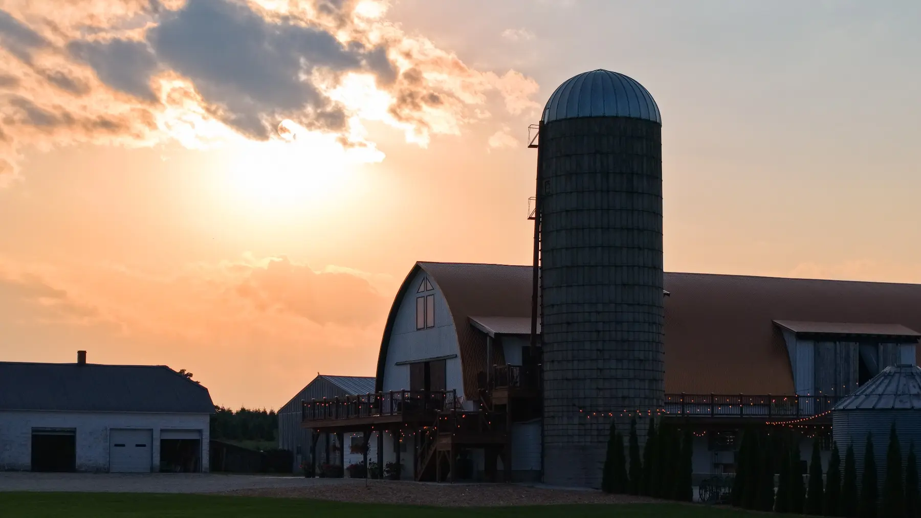
A Wisconsin barn and silo silhouetted against a warm evening sky
Lane LedvinaOwner & FAA Part 107 certified pilot
Behind the camera

The person behind
the perspective.

I’m Lane Ledvina, the owner and FAA-certified pilot behind Sky High Photography. I’m a local high school student who turned an interest in drones and photography into a business.

I especially enjoy local businesses, properties, and projects that change over time. From Aissen’s Tree Farm to a job in progress, I look for the view that shows the whole setting. You’ll work directly with me to plan the flight and choose the content that fits your project.

  • Customer-focused planningDeliverables are shaped around your audience, goal, and timeline.
  • Safety-conscious operationsWeather, surroundings, people, property, and airspace are considered before flight.
  • Polished final deliveryThoughtful selection and editing turn raw captures into finished work.
Where I fly

Serving Green Bay and Northeast Wisconsin.

Sky High Photography is based near Green Bay and travels for projects throughout Northeast Wisconsin. If your location is not listed, ask—there is a good chance I can still help.

Ask About Your Location
Primary service area
  • Green Bay
  • Luxemburg
  • De Pere
  • Denmark
  • Kewaunee
  • Algoma
  • Door County
  • Surrounding areas

Travel and flight availability are confirmed with your quote.

Common questions

What to know before booking.

Open any question for a quick answer, or contact me if your project is unusual.

What happens if the weather is bad?

Drone flights depend on safe wind, visibility, and precipitation. If conditions are not safe or would hurt the quality of your media, we will choose another time.

Can you fly anywhere?

Not every location is immediately flyable. I review the airspace, nearby people and property, site access, and any required authorization before confirming the flight.

Do you provide both photos and video?

Yes. Packages can include aerial photos, video clips, or both. Editing is available when you want polished files ready for listings, websites, social media, or keepsakes.

When would I need a custom quote?

The starting-price calculator covers most projects. A custom quote may be needed for unusual travel, airspace, access, timing, recurring work, or a project that does not fit the standard location and editing choices.
Plan your project

Build your quote.

Choose the number of locations, then add the editing services you need.

01 / Location coverage

Start with the place.

The location fee covers travel, flight planning, on-site flying, and delivery of the captured content. Editing services are selected separately.

One location
Second location
Add
Each additional location
Add
Your starting price updates as you go.
02 / Editing add-ons

Choose the finish.

Select any editing services you need.

Not sure which option fits your project? Contact Sky High Photography for a fast, personalized quote.

03 / Your project details

Let’s make it happen.

Send your selections with a few details, or get in touch for a custom project.

Start your project

Send the package you built, or describe a custom route, unusual access, recurring work, or anything else that needs its own price. Gmail will open with your request filled in so you can review it before sending.

A flexible or alternate date can be included in your message.

Thank you for your quote request.

I'll get back to you as soon as possible with more information about your project.